Can AI Help Cool the World’s Hottest Cities?

What do the world’s hottest environments have in common?
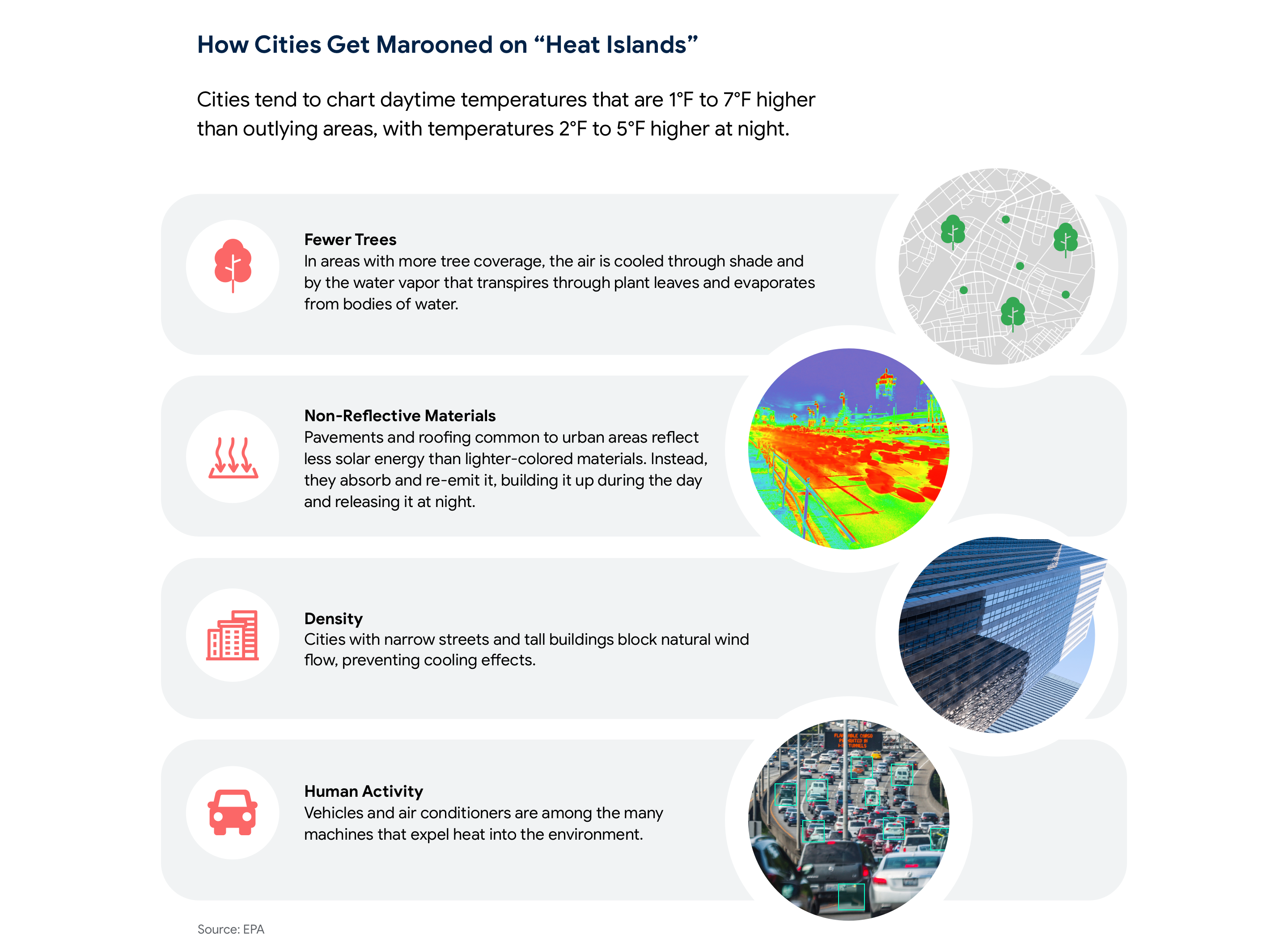
According to NASA, these locations tend to feature lots of rock and stone, but little water and few plants or trees. They’re also often characterized by dark colors.
If you’re picturing an arid desert, that’s accurate. But the description also mirrors many urban landscapes, where nature is overshadowed by man-made surfaces that absorb heat during the day and release it at night.
Even the naked eye can pick up on these differences by scanning the Satellite View feature on Google Maps, says Yael Maguire, Vice President and General Manager of Geo Sustainability at Google. No stranger to this view, Maguire is leading the effort to apply AI to mapping data to help minimize the human impact of climate change.
“If you’re looking at a Satellite View image that’s mostly green, you understand that there are trees there that can provide shade,” he says. “Compare that to an image that’s mostly gray—lots of concrete and asphalt. It’s easy to guess which one will feel hotter.”
This observation reflects the phenomenon of urban heat islands—areas with elevated temperatures surrounded by cooler regions. Maguire and his team are leveraging AI to map tree coverage and cool roof solutions that could mitigate extreme heat in these affected areas.
Extreme heat already claims more lives in the US than hurricanes, floods and tornadoes combined, according to the Centers for Disease Control and Prevention (CDC). As the global population affected by extreme heat is projected to drastically rise, finding solutions is critical.

Left unchecked, the problem of urban heat islands is expected to worsen. Migration to urban areas is on the rise, and according to the United Nations, around 70% of the world’s population will live in a city by 2050.
Global temperatures are also rising, and the past nine years have witnessed the highest temperatures in recorded history. October 2023 was the hottest October ever recorded, per the World Meteorological Organization, maintaining a pattern set by June, July, August and September of this year—putting 2023 on track to be the warmest year ever recorded.
While governments and organizations around the world are working to reduce greenhouse gas emissions that are contributing to these elevated temperatures, action needs to be taken to help urban centers adapt in the near term. How can cities minimize residents’ exposure to extreme heat, which kills nearly half a million people a year?

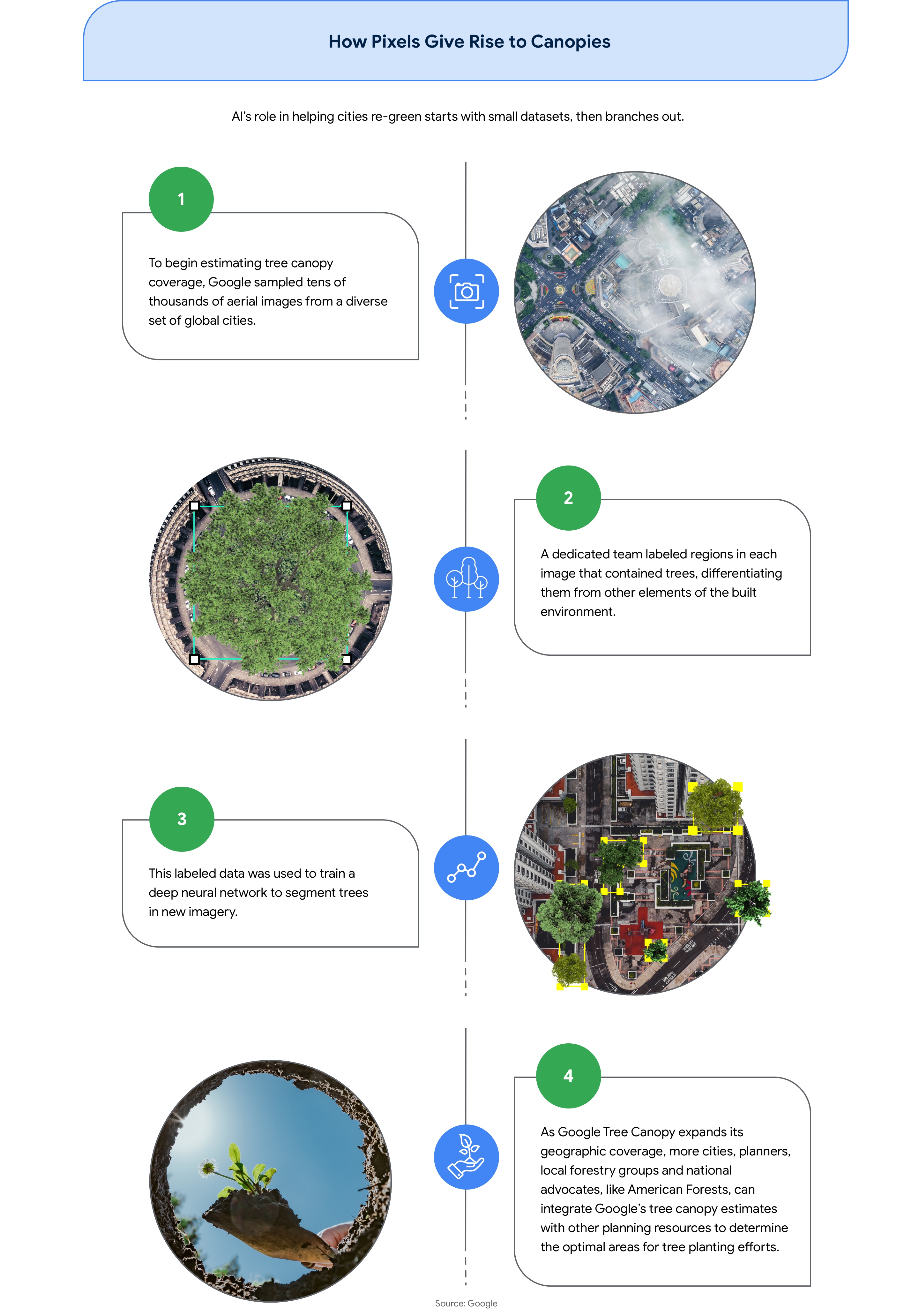
Traditionally, cities and local governments have relied on manual methods to assess tree coverage, such as people physically counting trees or analyzing aerial and satellite imagery. But artificial intelligence is proving to be an effective tool to enable faster and more cost-effective visibility.
This promise of enhanced analytical capabilities comes to life in the Tree Canopy feature of Google’s Environmental Insights Explorer, an open and freely available dashboard where city planners and community organizations can zoom in on specific regions to better understand climate change through actionable data.
These insights are integral in building a more sustainable future because trees play a vital role in cooling urban areas, and also absorb and store CO2 while releasing oxygen back into the air, offsetting a small portion of anthropogenic CO2 emissions. With the introduction of Tree Canopy, city planners can quickly evaluate existing tree coverage and formulate actionable strategies to expand it with precision.
Tree Canopy features an image-recognition model that differentiates trees in overhead imagery of cities, and scales that across an entire urban area to offer a quick overview of where trees cluster—and where they don’t.
“A pixel from a satellite or airplane, paired with AI and human experts, can become something extraordinary,” says Maguire.
“Imagery—especially high-resolution aerial imagery—paired with AI can very quickly assess a city, block by block, to determine where to focus tree-planting efforts—a process that would otherwise be too costly for most cities and would typically only be done every five to eight years,” he says.

Google Tree Canopy now covers more than 2,100 cities around the world. Austin, Texas, for example—where the temperature climbed to 110°F in August—has leveraged Tree Canopy to understand where high temperatures affect vulnerable residents, and its Community Tree Priority Map has been followed by planting initiatives.
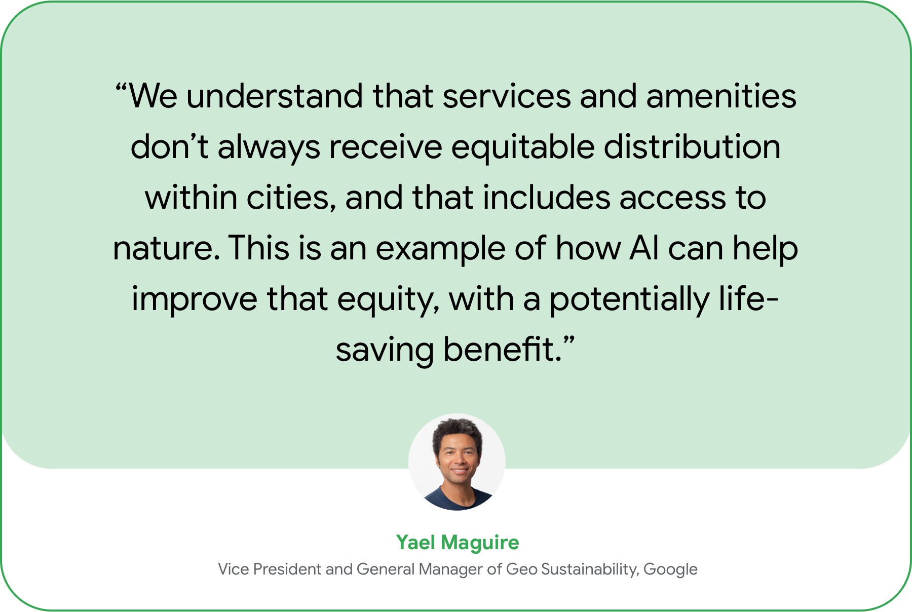
Given the fact that low-income communities and communities of color are disproportionately exposed to the heat island effect compared to neighboring communities in the same cities, the tool can help inform efforts to mitigate the inequities exacerbated by climate change.


While newly planted trees can take years to mature, another line of defense against urban heat buildup can be deployed in the span of a day or two.
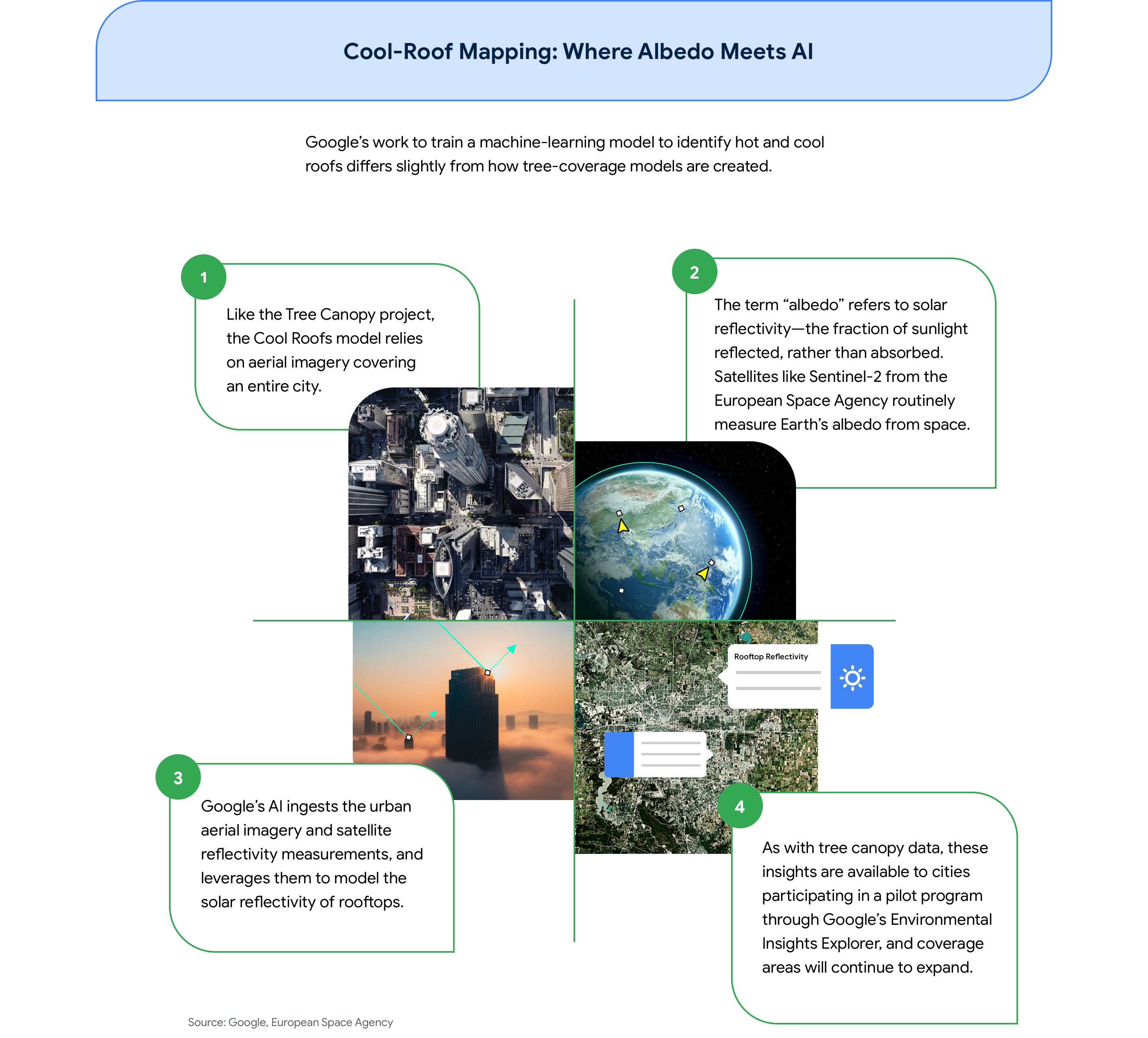
Much like concrete and asphalt, rooftops can function as heat sponges. That’s why Google is developing Cool Roofs, an AI-powered mapping effort to help cities facilitate the transition to reflective roofs that help mitigate the detrimental impact of urban heat islands.
Darker rooftops absorb heat, while lighter ones reflect it. Like the innumerable white structures dotting the hills of the Greek isles, lighter building surfaces have long been relied upon to keep interiors cool in warmer climates.
It’s no surprise that buildings that apply a reflective coat of paint to their rooftops—or those with roofs that feature heat-reflecting materials—keep occupants cooler. The EPA estimates that cool roofs can lower maximum indoor temperatures by 2.2°F to 5.9°F—reducing the use of air conditioning, pulling less power from the grid and helping to shrink a city’s carbon footprint.
“The benefits are clear,” Maguire says. “But, just as with tree coverage, the challenge for cities is understanding which neighborhoods are absorbing heat and which ones are reflective in order to take action.”
Cool Roof’s AI capabilities offer a scalable way to map the relative reflectivity of roofs block by block across urban areas.
Ultimately, Google hopes governments and city planners will be able to use the Cool Roofs tool to help identify and advocate for interventions that keep indoor temperatures down and keep people healthier during heat waves.

In Maguire’s view, these AI applications do more than merge datasets. By analyzing data at speed—and at scale—these tools enable leaders to more efficiently gain both the big-picture perspective and the detailed insights needed to take meaningful action, helping cities move more quickly to improve livability and sustainability.
“In business, we often hear about taking the 30,000-foot view,” says Maguire. “The beauty of using AI in these ways for cities is that we can literally take that view, so that people on the ground can use it to make life better around them.”
